
Polynyas are areas in polar seas that remain open or with minimal ice cover through most of the year. They can result from currents, tides or winds interacting with coastal and subsurface features. They represent critical habitat for many arctic species.

In order to assess the probability of open water occuring in the Canadian Arctic, we classified daily sea surface temperature images from the MODIS sensor over a timeframe of eleven years.

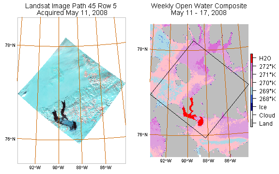
In order to minimze the effects of cloud cover, the classification process was stacked and combined to produce a weekly composite. We used Landsat imagery to quality control the results.
The classification results were very good for detecting thin ice and penetrating fog and haze.

Annual variation in ice cover was easy to assess. Our results were delivered as spatial probability of occurence statistics for the entire region.

Click here to return to the GeoAnalytic main page. Click here to see more of our project work.